Schedule a demo with us
We can help you solve company communication.
Geographic Information Systems and Digital Twins are at the heart of all modern urban decision making processes. By converting time series data from real-time video analysis into geospatial mobility data, CityScenes is able to create an invaluable datasource for smart city innovators.
CityScenes enables urban policy makers to gain valuable insights into various aspects of urban mobility, such as congestion patterns, car and bus trajectories, pedestrian and cyclist behavior and interaction patterns between them. Understanding mobility patterns supports the identification of trends and areas in need of improvement.
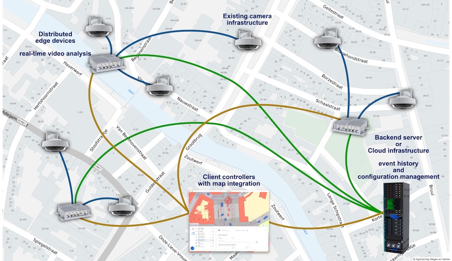
By leveraging existing city camera networks, our solution ensures both cost-effectiveness and a minimized environmental impact. CityScenes's open architecture allows for easy integration with other smart city systems and data sources, creating a unified platform for city officials.
The CityScenes platform is designed to accommodate cities of all sizes and stages of development, making it a versatile solution for both growing metropolises and smaller urban centers. It can easily be scaled up or down to meet the specific needs of each city.
With CityScenes's real-time monitoring capabilities, policy makers can quickly identify and respond to emerging mobility issues, enabling them to proactively address challenges and improve the overall efficiency of the urban modes of transport.
Processing video streams demands for privacy protection at the source. CityScene's video analysis algorithms process data in a way that fully respects the privacy of citizens, ensuring GDPR compliance and establishing trust between policy makers and the public.
Your existing camera infrastructure harbours a invaluable source of mobility data that can be turned into live and actionable intelligence on the interactions of your citizens with your city.
Don't worry about video data interpretation and turning it into accurate GIS datasets, we have it covered. We've built an innovative remote camera calibration method that takes care of geometric interpretations of your city's scenes.
We optimize our AI algoritms in-house for accuracy and speed to deliver high-quality data, in real-time from your existing city-wide camera systems. We deliver the following sources:
detailed traffic analysis (pedestrians, bicyclists, motorcyclists, cars, trucks, busses)
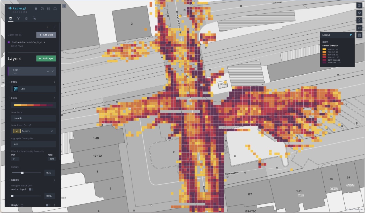
crowd density and crowd behavior

Measurements are collected per square meter and sampled at one observation per second. We can aggregate per hour, per 15 minutes, or any time window you need. Once the fine-grained data is available, you can aggregate it by any surface area to get the average number of observations for the given time window in that area.

You have a city to run. Stop worrying about data collection flows, designing dashboards, keeping your software up to date. Let us do that for you.
Absolutely. We provide an incremental system, start small and add devices as needed.
Yes. We work with yearly licenses, all software updates are included and managed remotely.
Not at all! Our edge devices are added to your network, the camera streams are configured and the video ouput calibrated for geospatial characteristics of the environment. That's it.
All fixed overview cameras are supported. Cameras that can move (pan-tilt-zoom) are currently not supported.
Elevate your city's mobility, safety, efficiency, and quality of life with CityScenes.